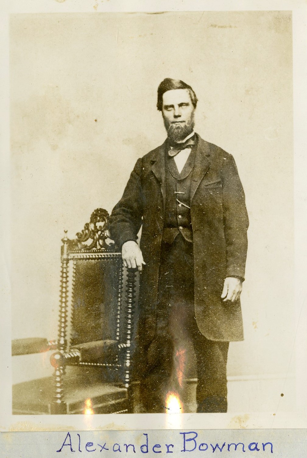
Alexander Bowman (1826-1907) was a carpenter, secretary for a teacher’s association, architect, and surveyor who moved his family from New York to Illinois to further his educational and business prospects despite his persistent health and financial issues. Although some of the materials and edifices he created remain extant to this day, they do not add up to tell a complete life story. Bowman appears in the paper trail irregularly throughout the second half of the 19th century: a census indicating his move to West Urbana in 1857, a series of advertisements for his skills as an architect and civil engineer published in the Central Illinois Gazette and other newspapers, and county records verifying him as the designer of the fourth iteration of the county courthouse (1859-1861) at the cost of $30,000.
Here in the Champaign County Historical Archives, we know him as the creator of two prominent early maps, the 1858 Urbana-West Urbana Map and the 1863 Champaign County Map. Both maps feature drawings of significant homes and buildings along the borders. The 1858 map is notable for its use of the term West Urbana as the town’s name would be changed to Champaign in 1860. The 1863 map serves as an early plat map of Champaign County and is consulted regularly by staff and patrons.
Bowman and his family moved once again to neighboring Vermilion County, IL, where he found work as the county surveyor for 35 years and served three terms as their city engineer. He died on April 10, 1907. The Champaign Daily Gazette memorialized him under the headline “Died in Danville Wednesday: The Architect of the Old Champaign County Courthouse.”

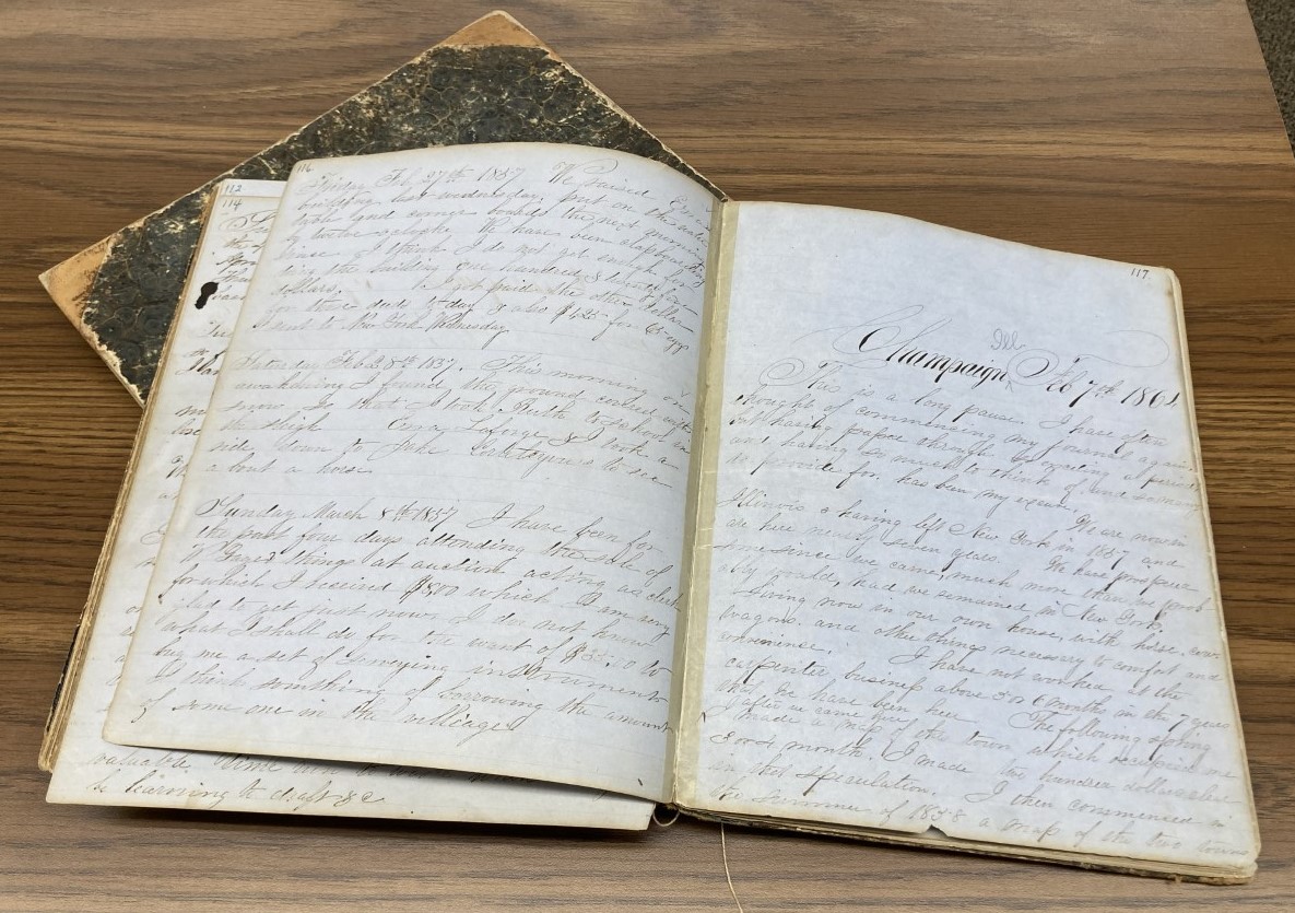
Long after his death, two of his journals were donated to the Champaign County Historical Archives in May 2017 by one of his descendants, Jim Bowman. These two journals kept by Alexander Bowman are primarily from 1850-1854 and predate Bowman’s time in Champaign County, but the last few pages of the second journal contain passages from 1857 and 1864. In these pages, Bowman mentions his Champaign County occupations, including mapping the towns and county and designing the fourth iteration of the Champaign County Court House. Here he is discussing his 1858 Urbana-West Urbana Map:
“The following spring after we came here I made a map of this town which occupied me 3 or 4 month. I made two hundred dollars clear in that speculation. I then commenced in the summer of 1858 a map of the two towns Urbana and West Urbana now Champaign which being a very large enterprise took me longer than I expected and longer than it ought to have done. I however in spite of the bad times made about $100, over and over supporting my family and paying expenses”- Alexander Bowman, The Alexander Bowman Diaries, 1852-1864. Transcribed by Karla Gerdes
Three copies of the 1858 Urbana-West Urbana map are known to survive. The Urbana Free Library is the location for two of the maps. One used to hang in the former Urbana City Building on Elm and Broadway. It was restored in 2005 and can be seen proudly hanging outside the Champaign County Historical Archives on the second floor of The Urbana Free Library. The British Library holds a third copy, where it was considered for placement in their Magnificent Maps exhibition in 2010.
- Ryan Chaglasian (former Archives Practicum Student) and Sherrie Bowser (Archives Librarian)

