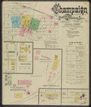
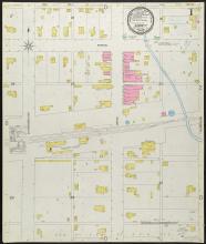
The Champaign County Historical Archives holds over 500 historical and current local maps, plat books, and atlases.
Of all the maps in our collection, Sanborn Fire Insurance maps may be the most popular maps used for local history and family history research. What are Sanborns and what information do they contain? Originally produced to help insurance companies determine fire insurance rates, these maps are an invaluable tool for research into urban properties that existed in the late nineteenth and early twentieth centuries. At a time when cities were growing exponentially and regulations on construction were minimal, these maps depict a detailed snapshot of downtown
areas.
Sanborns provide a wealth of information, including the size, shape, and outline of individual structures, property boundaries, lot numbers, street names, and even the width of a street. Since these maps were originally intended to show features that could affect a property’s vulnerability to fire, earthquake, or flood, they also depict railroads, pipelines, wells, and city dumps. Did you know you can access 30+ Champaign County Sanborn maps through the University of Illinois' digital collections? You can also access over 1,600 additional Illinois maps through their website.
For more information about Sanborn Fire Insurance Maps, visit:
This 2018 post from our blog: Mapping America: The History of Sanborn Fire Insurance Maps
Fire Insurance Maps in the Library of Congress: http://www.loc.gov/rr/geogmap/sanborn/san4a1.html
University of Illinois Digital Collection of Sanborn Fire Insurance Maps: https://digital.library.illinois.edu/collections/6ff64b00-072d-0130-c5bb-0019b9e633c5-2
- Donica Martin
Archives Director


